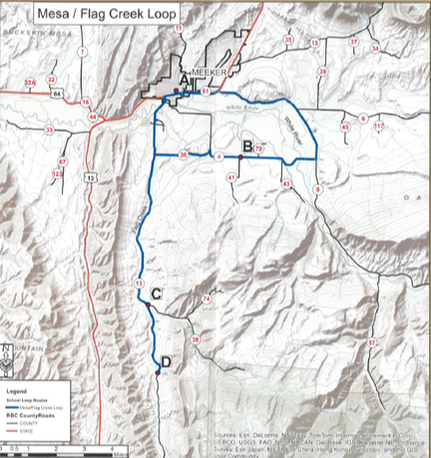
The first school was formed by the people making homes and businesses in the buildings that had been sold and left behind in 1883 by the soldiers of the “Camp of The White River.” This tour starts at the first school site, includes a short distance up the White River, goes across to the Mesa School, and then up Flag Creek past Lime Kiln. Homesteaders here found rich farming and grazing land plus raw materials needed for building. This tour is about 33 miles.
Mesa and Flag Creek Loop:
DRIVING INSTRUCTIONS:
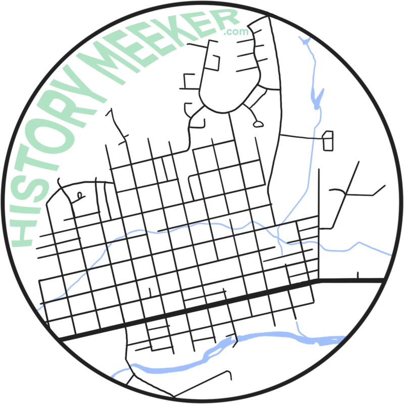
Begin on Fourth Street between Park Street and Main Street at the south west corner of Saint James Episcopal Church property. The Military Hospital School took up this entire block (Point A). GPS N40°02.305 W107°54.663
Drive .1 mile to Market Street (State Highway 13) and turn left. Drive 1.7 miles to the intersection of County Road 8 and State Highway 13 taking the right turn onto County Road 8. Drive 5 miles to County Road 4 on your right. Turn right on County Road 4 and drive 2.9 miles to the Mesa School site on your left (Point B). It is best to pull off just past the sign at County Road 41 and walk back as there is no safe pull off area by the sign. GPS N40°00.317 W107°51.967
Continue on County Road 4 for 1.2 miles to County Road 36 and turn left onto County Road 36. Drive 2.1 miles to the intersection of County Road 36 and County Road 13. Turn left on County Road 13 and go 5.8 miles to the turn off for Hay Flats area on your left for the sign to Lime Kiln School (Point C). Lime Kiln is at the end of this road but on private property and cannot be viewed. GPS N39°55.658 W107°55.539
Continue to drive 2.7 miles on County Road 13 to Flag Creek School site on your right(Point D). As of 2013 the horse barn for the school is still standing.
GPSN39°53.297 W107°55.084
This is the turnaround point for the Mesa/Flag Creek Loop. Go back down County Road 13 for 10.6 miles to the Stop sign at the intersection of 10th Street and County Road 13. Turn left and go over the bridge to the intersection of 10th Street and State Highway 13. Turn right on State Highway 13 to Meeker.